 |
 |
 |
 |
 |
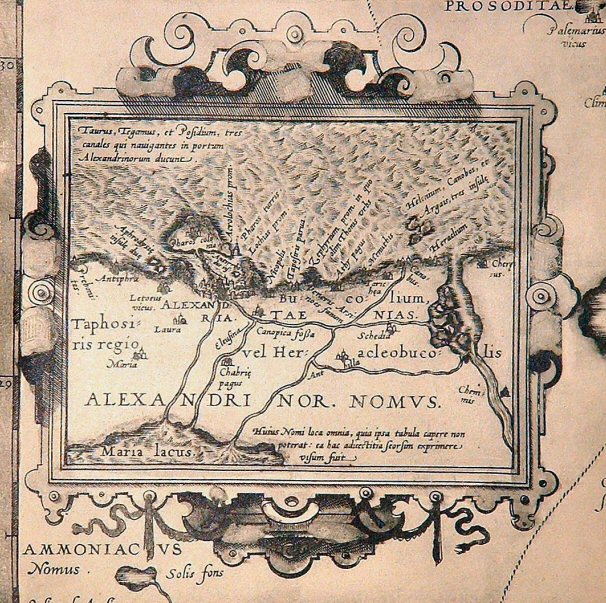 |
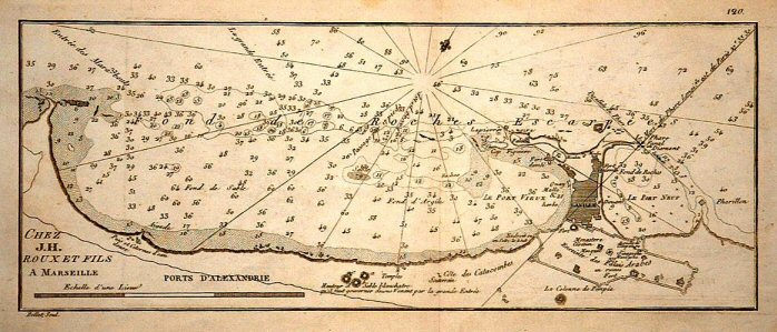
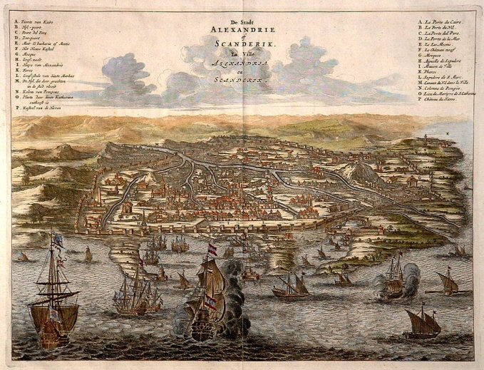
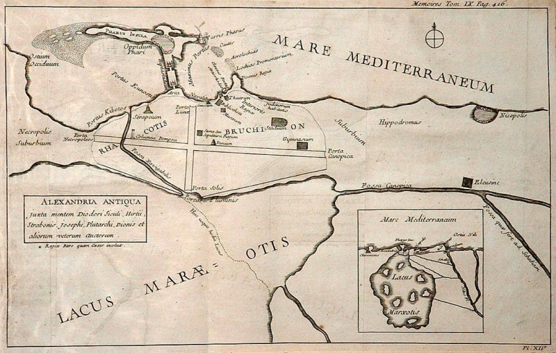
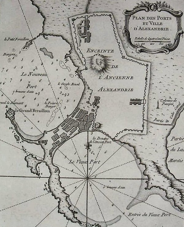
| Thomas Walsh, Journal of the Late Campaign in Egypt (1803), 1801 | J. Roux and Sons, c.1780 | Razaud, 1687 (Jondet VIII, 1921) | Richard Pococke, Description of the East - Dutch edition (1743 [1776]), 1738 | Pierre Belon, Les observations de plusieurs singularitez et choses memorables trouvees en Egypte (published 1554), 1548 | Abraham Ortelius, Theatrum Orbis Terrarum (inset map on Aegyptus Antiqua leaf - done in 1570, probably based on Geography of Claudius Ptolemy c. AD150 and other ancient accounts) |
 |
 |
 |
 |
 |
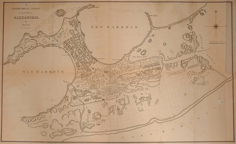 |
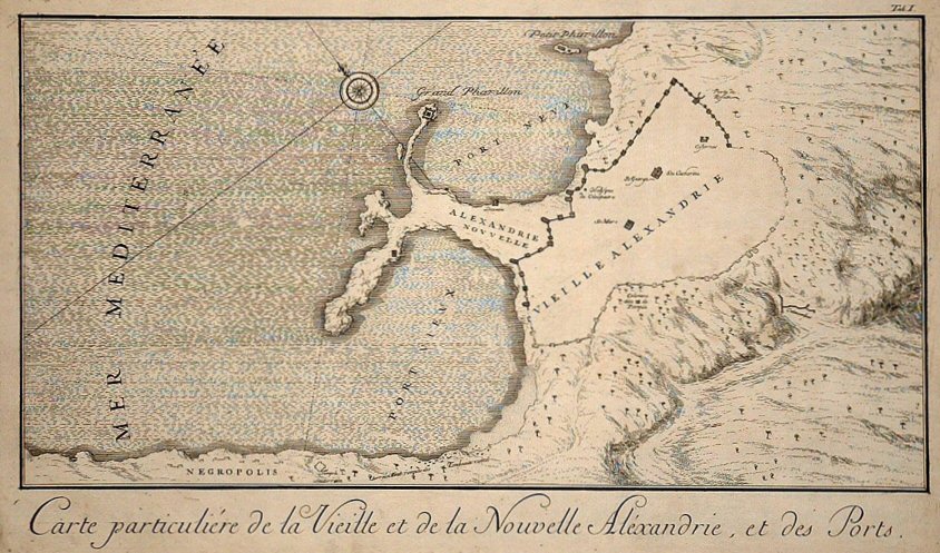
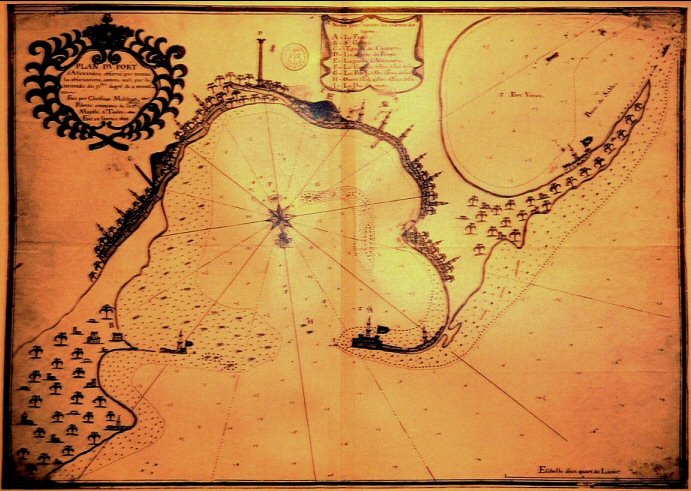
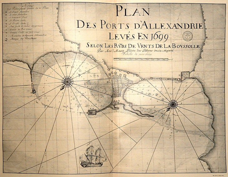
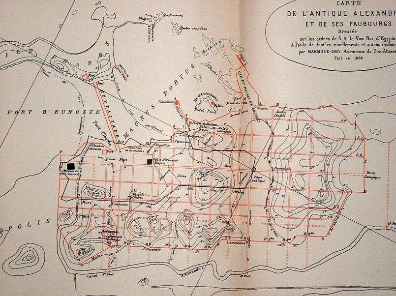
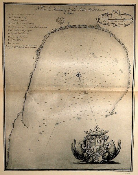
| Panoramic plan by Frederick Norden, Travels in Egypt & Nubia (1755), 1737 | Map by Frederick Norden, Travels in Egypt & Nubia (1755), 1737 | Christian Melchien, 1699 (Jondet IX, 1921) | Antoine Massy, 1699 (Jondet X, 1921) | Mahmoud Bey, Memoire sur l'Antique Alexandrie (1872), 1866 | Henry Salt (Published in 1811 in G. Annesley, Voyages and Travels to India, Ceylon, the Red Sea, Abyssinia and Egypt in the Years 1802-1806, Vol. 4), 1806 |
 |
 |
 |
 |
 |
 |
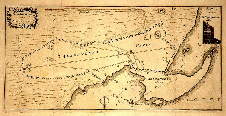
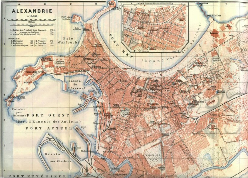
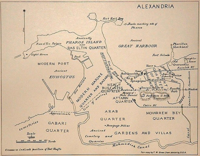
| Baedeker Guide Map, Aegypten und Sudan, 1913 | D. G. Hogarth, Egyptian Exploration Fund, 1895 | Description de l'Egypte, Plate 84 in Etat Moderne (1821-9), 1798 | Description de l'Egypte, Plate 31 in Antiquites V (1821-9, 1798) | Marquese de la Garde, 1713 (Jondet XI, 1921) | Olfert Dapper, -1670 (derivative from Braun & Hogenberg) |
 |
 |
 |
 |
 |
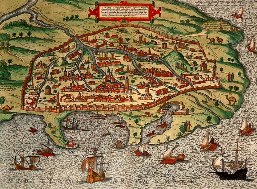 |
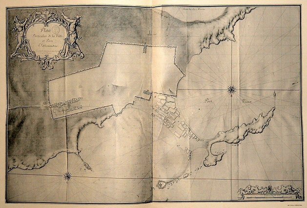
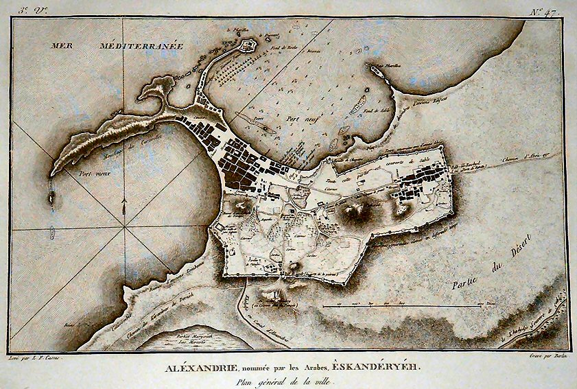
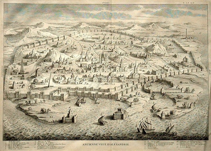
| D'Anville, Memoires sur l'Egypte ancienne et moderne (1766), (largely based on the map of 1687 by Razaud) | Ugo Comminelli, Codex Urbinate, Vatican Library, 1472 | Louis-Francois Cassas, Voyage Pittoresque de la Basse Egypte (1799), 1785 | Calmet, 1730 (derivative from Braun & Hogenberg) | Evaristo Breccia, Alexandrea ad Aegyptum (1922), [attributed to M. Bartocci] 1914 | Braun & Hogenberg, Civitates Orbis Terrarum (c.1573), information c.1530 |
 |
 |
 |
 |
 |
 |
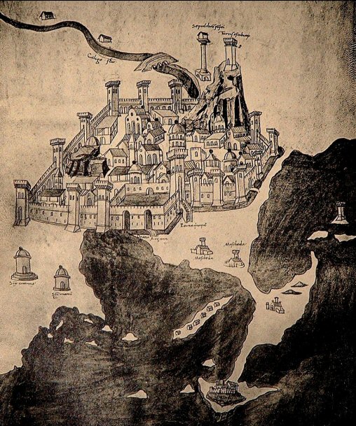
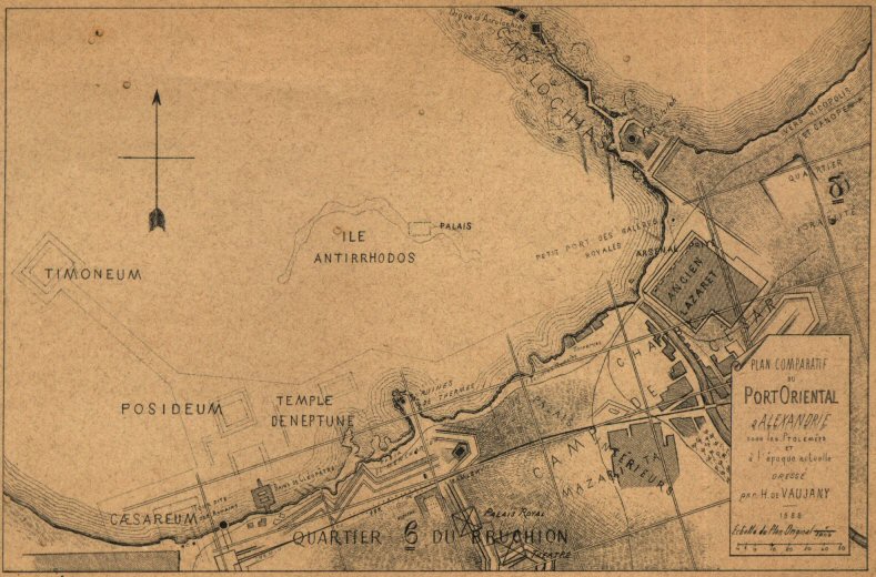
| M. Bonamy's reconstruction of ancient Alexandria, which is the oldest known reconstruction from a paper given on 31st August 1731, published 1736 | H. de Vaujany, Recherches sur les Anciens Monuments Situe sur le Grand-Port d'Alexandrie, 1888 |
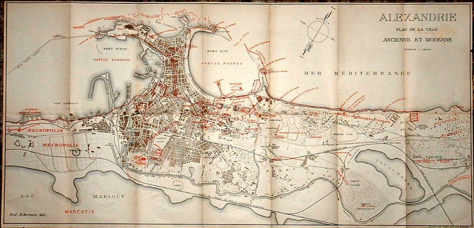
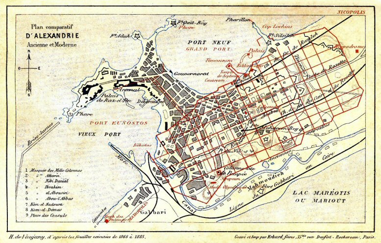
Map of modern Alexandria
with Mahmoud Bey's plan of the ancient streets superimposed in red,
published in H de Vaujany's guide-book: Description de l'Egypte, Alexandrie et la Basse-Egypte, Paris 1885 |
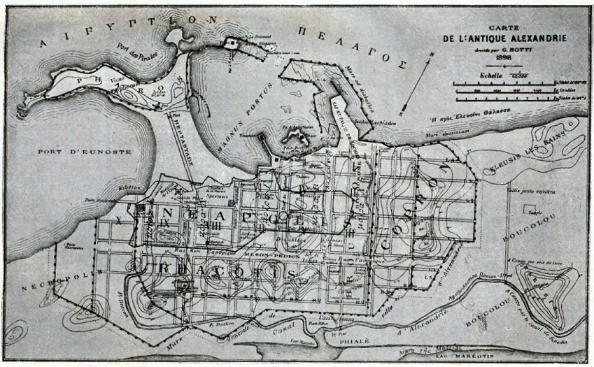
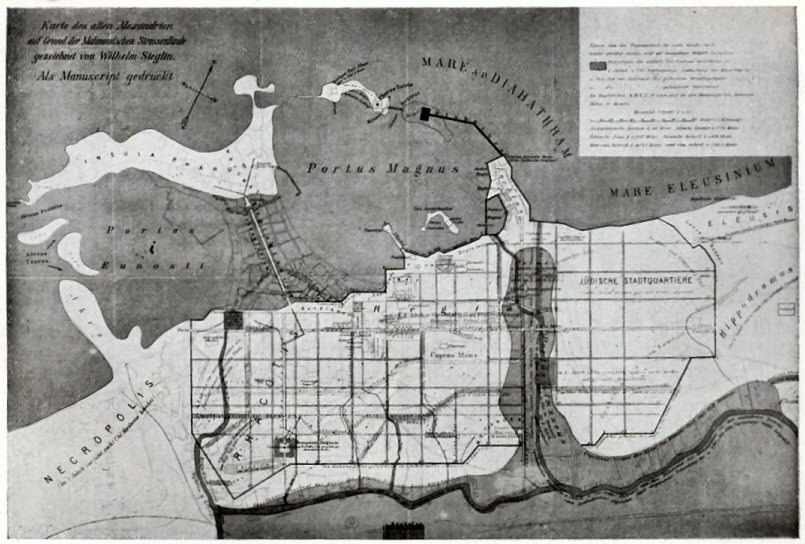
Reconstruction of ancient Alexandria drawn by G. Botti in 1898. Although fundamentally deriving from the Mahmoud Bey map, the extra walls shown in this reconstruction seem too elaborate and the relocation and widening of the principal streets is probably incorrect. | Reconstruction of ancient Alexandria drawn by Tassos Neroutsos Bey to accompany his book, L'Ancienne Alexandrie, published in 1888. Based on the Mahmoud Bey map, but with the addition of details deriving from archaeological investigations or ancient sources. | Reconstruction of ancient Alexandria drawn by Wilhelm Sieglin (Sieglin archaeological expedition 1898-1902). Based on the Mahmoud Bey map, but with the addition of details deriving from archaeological investigations or ancient sources. |
 |
 |
 |
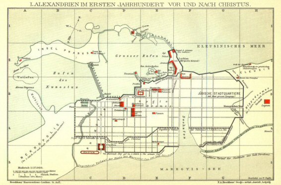 |
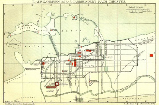 |
 |
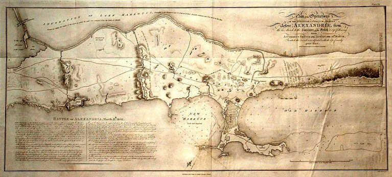
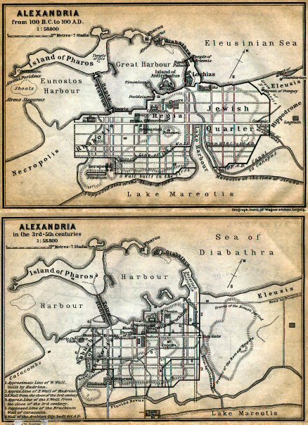
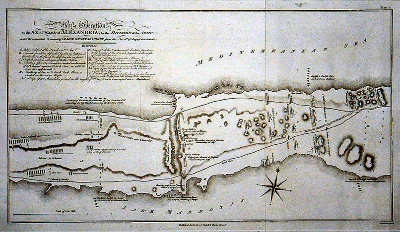
| Maps of ancient Alexandria published in the 1914 Baedeker guide and based on the work of the Sieglin expedition | Confrontation between the French and British forces to the east of Alexandria in 1801 by Thomas Walsh 1803 | Confrontation between the French and British forces to the west of Alexandria in 1801 by Thomas Walsh 1803 | Reconstruction of ancient Alexandria between the first century BC and the first century AD published circa 1893 based on the research of W. Sieglin | Reconstruction of ancient Alexandria between the third and the fifth century AD published circa 1893 based on the research of W. Sieglin | Alexandria from Recueil des Principaux Plans des Ports et Rades de la Mer Mediterranée by Joseph Roux, published in 1764, this copy watermarked 1773 |
 |
 |
 |
 |
 |
 |
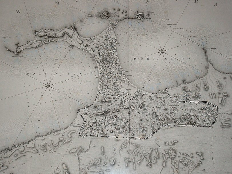
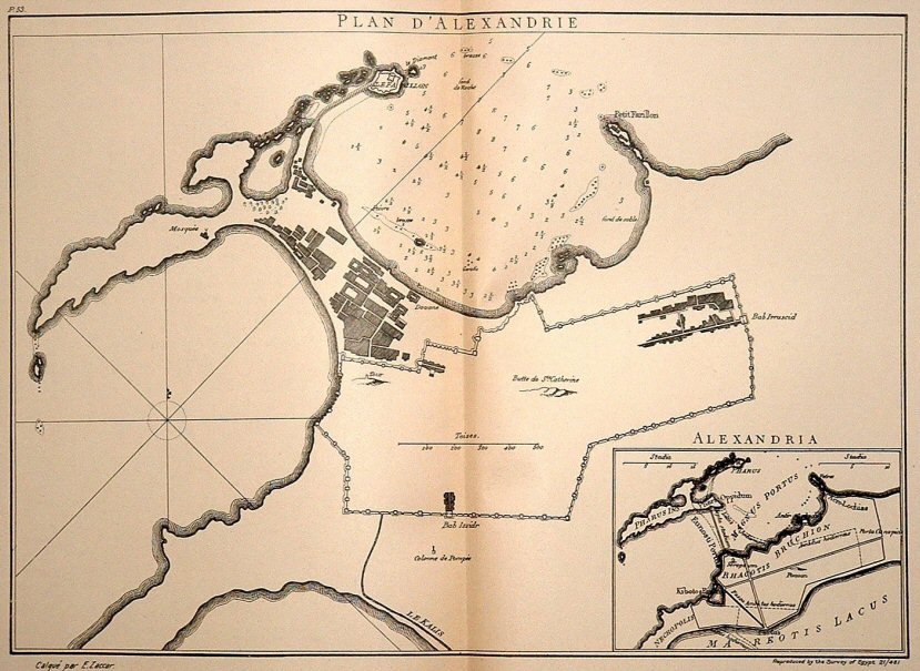
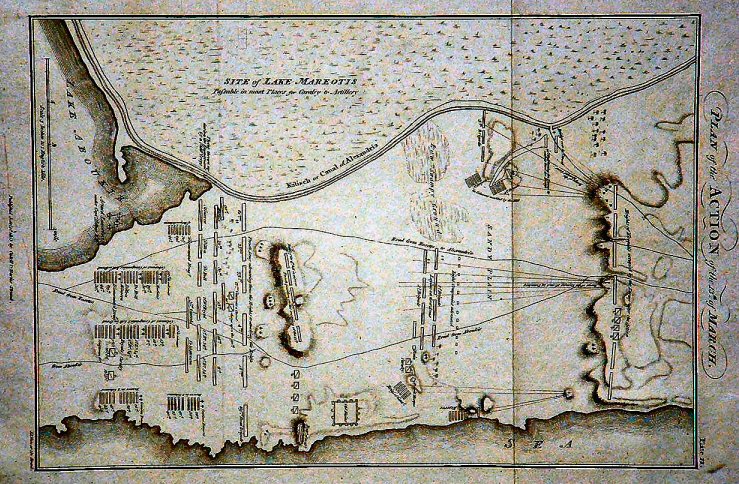
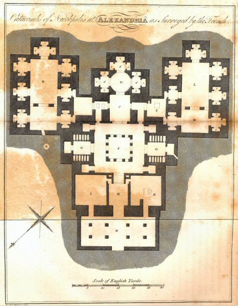
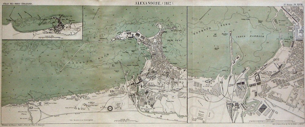
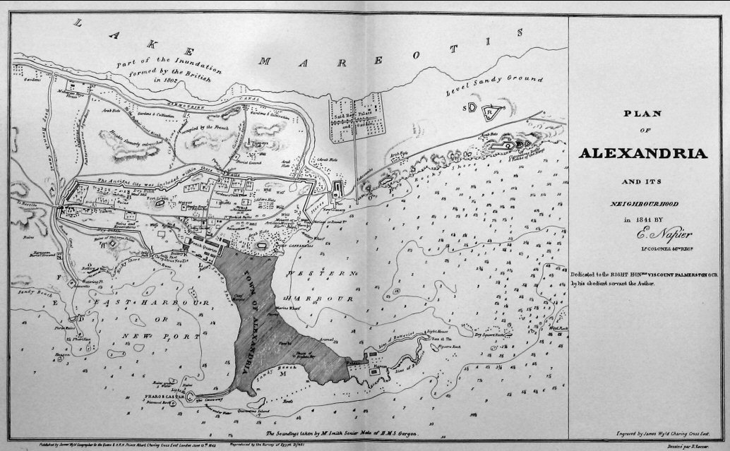
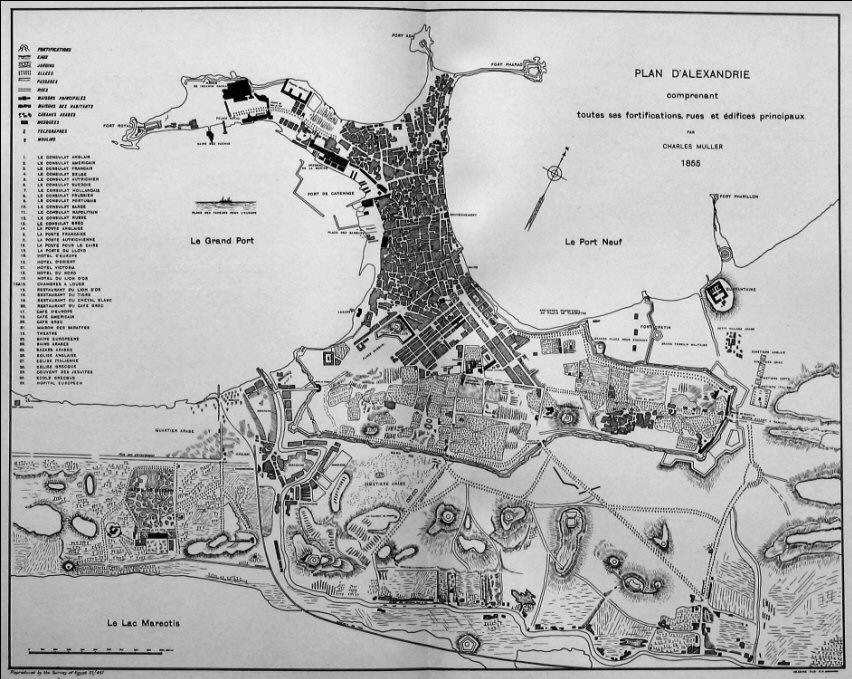
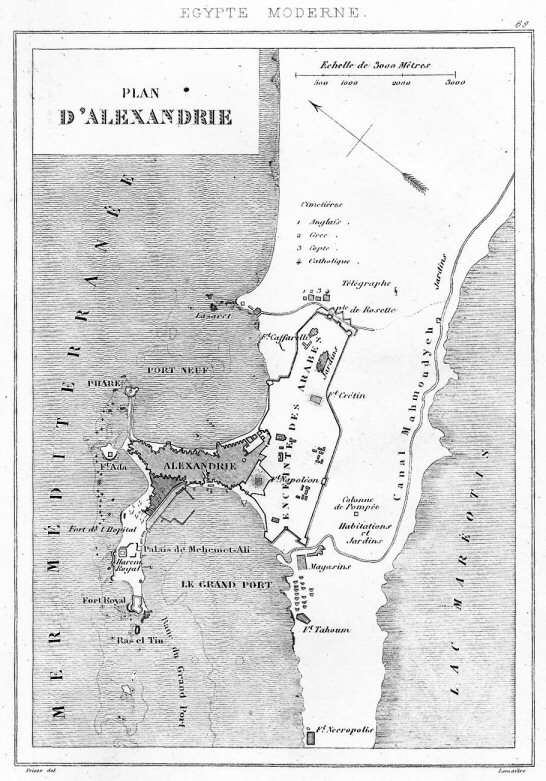
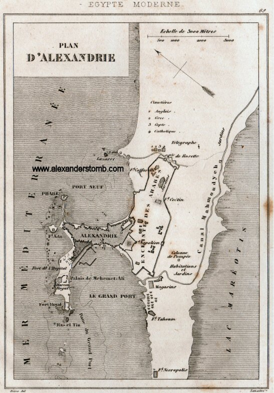
| Plan of the catacombs on the coast to the west of Alexandria from Clarke’s Travels | Plan of the city and harbours of Alexandria dated 1882, from Atlas des Ports Etrangers, Paris, Imprimerie Nationale, 1887 | Bellin’s map of 1764. A derivative of the Razaud map of 1687. | Plan of Alexandria and its neighbourhood in 1841 by E. Napier | Plan of Alexandria including all its fortifications, streets and principal buildings by Charles Muller 1855 | Plan of Alexandria in 1865 drawn up by Mahmoud Bey El Falaki at the time of his excavations to determine the plan of the ancient city |
 |
 |
 |
 |
 |
 |
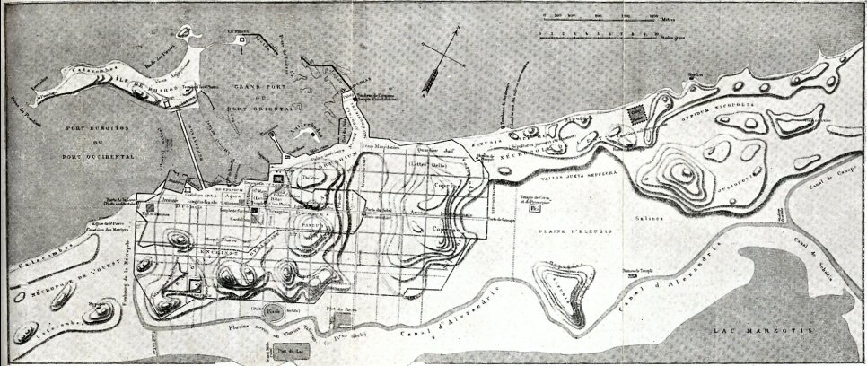
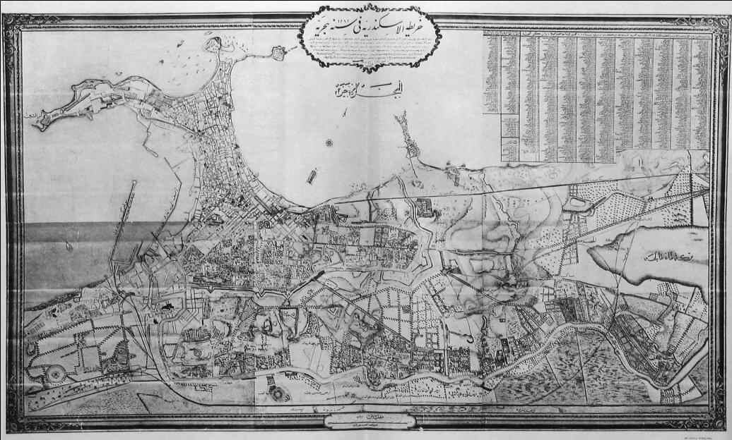
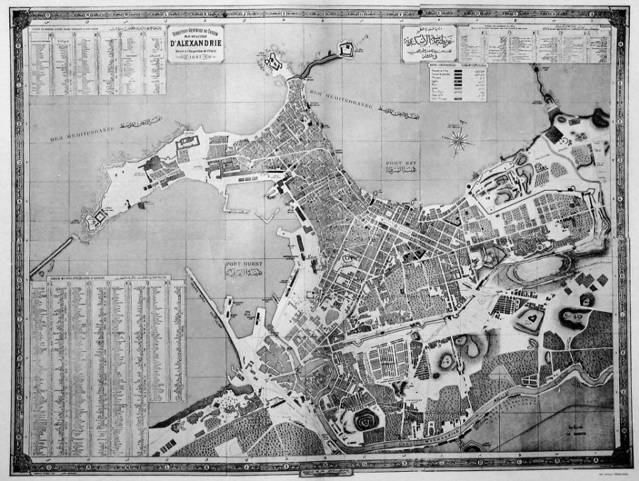
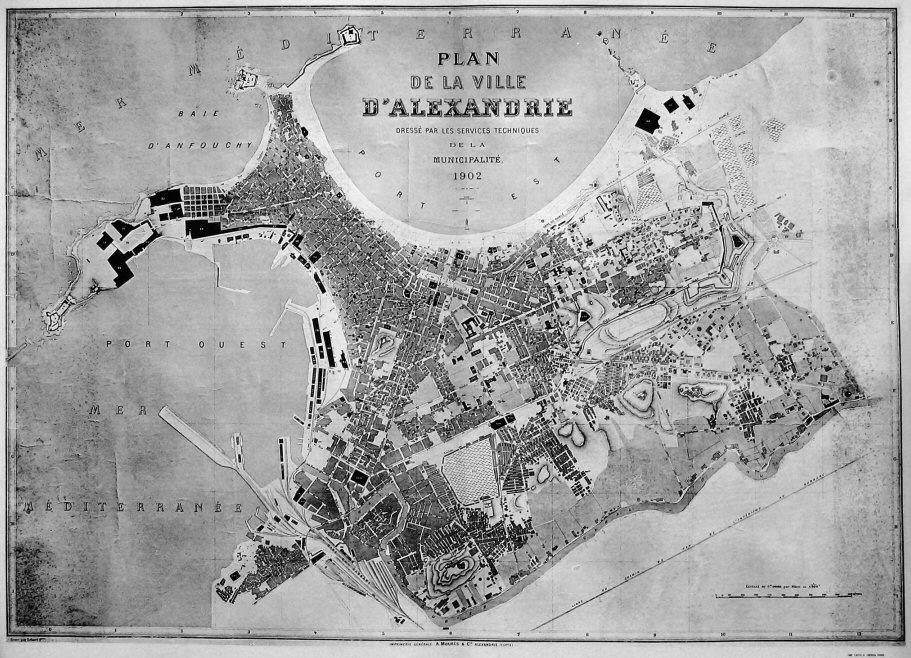
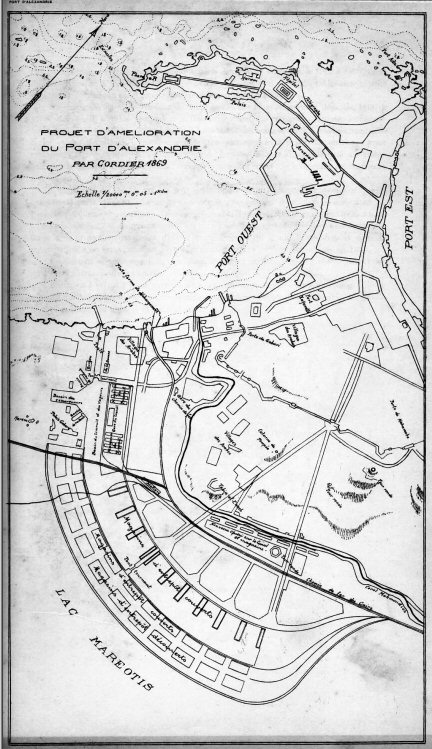
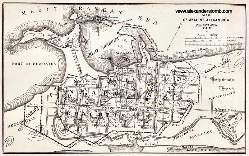
| Plan of the town of Alexandria in 1887 drawn up by the Western Inspectorate, General Management of the Tanzim | Plan of the town of Alexandria drawn up by the technical department of the municipality in 1902 | “Map of Alexandria in 1848 by Lemaitre showing the start of the expansion of the city on the Isthmus back into the enclosure of the medieval walls” | Plan for the improvement of the port of Alexandria by Cordier, 1869 | Reconstructed plan of ancient Alexandria drawn in 1898 by G. Botti, Director of the Greco-Roman Museum | Plan of Alexandria published in 1848 and based on earlier maps of the 19th century |
 |
 |
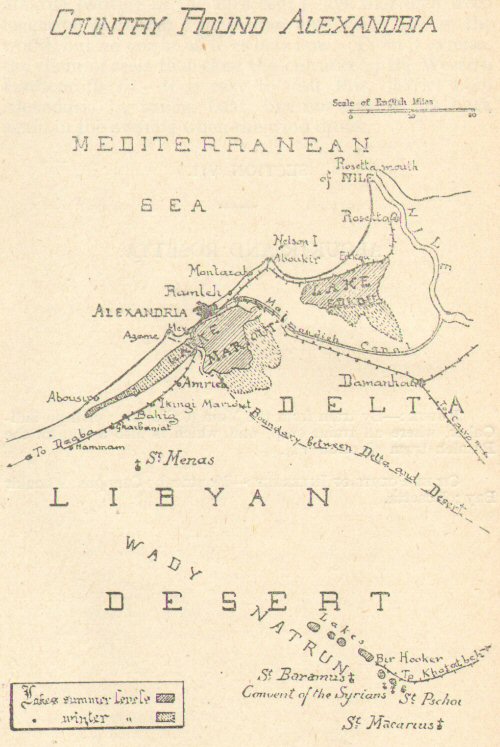 |
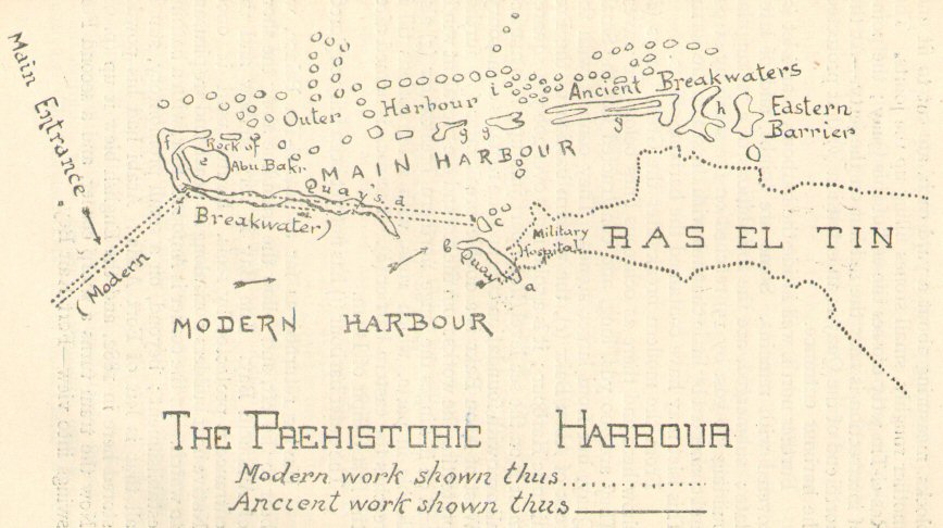 |
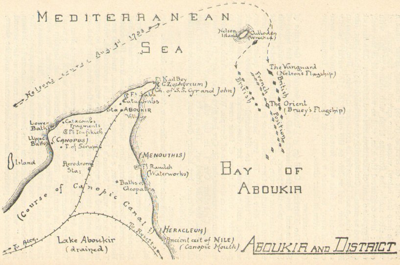 |
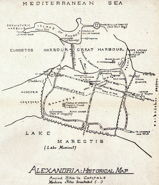 |
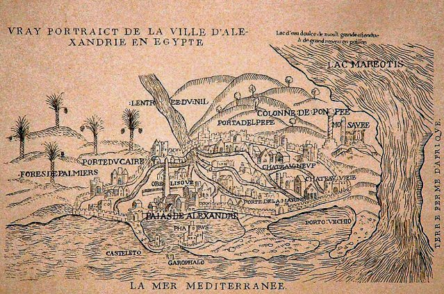
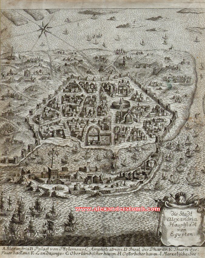
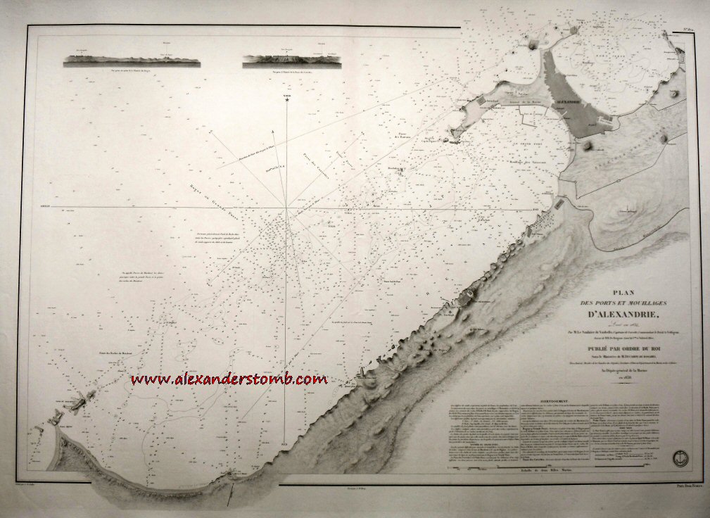
| German engraved plan of Alexandria with a unique pedigree (no obvious derivation) dating to earlier than 1710 | A French navigational chart of the coastline near Alexandria including Alexandria and its two main harbours – drawn in 1834 and published in 1838 | Forster’s map of the environs of Alexandria from the 1922 first edition of “Alexandria: A History and a Guide” | Forster’s map of an ancient harbour off Pharos Island at Alexandria from the 1922 first edition of “Alexandria: A History and a Guide” | Forster’s plan of the Battle of the Nile in Aboukir Bay near Alexandria from the 1922 first edition of “Alexandria: A History and a Guide” | Forster’s historical map of Alexandria from the 1922 first edition of “Alexandria: A History and a Guide” (NB somewhat imaginative) |
 |
|||||
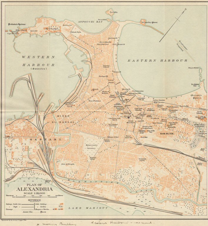
| Forster’s city plan of Alexandria in 1922 from a pocket in the rear cover of the 1922 first edition of “Alexandria: A History and a Guide” | |||||